The Iberian Peninsula remains under the significant influence of the storm Aitor. This climatic situation will lead to abundant rainfall in the northwest quadrant, with the region of Galicia, where locally persistent and heavy rainfall is expected. In addition, adjacent areas will experience an almost general increase in temperature , which is a notable phenomenon at this time of year.
Forecast of the AEMET
According to the forecast issued by the State Meteorological Agency (AEMET) Rain will be more likely on the Atlantic coast and in nearby areas. Galicia, as well as in the central Pyrenees. However, in the southeastern areas, low probability rainfall is expected, characterized by being weak and scattered, affecting areas of the south of Extremadura, the west and north of Castilla-La Mancha, as well as the environment Ebro and interior of Cataluña.
In the archipelago canario, Cloudy intervals are expected in the north, while the south will remain under conditions of few clouds. The trade winds will behave moderately during this period. As temperatures rise almost universally, a more marked increase in minimum temperatures is expected in the eastern half and in maximum temperatures in the Cantabrian coast, Ampurdán, and central areas. In the northern plateau, this rise could be notable, while weak frosts could be reported in the peaks of the Pyrenees.
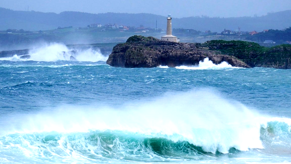
The southwest winds will be more intense compared to previous days, occurring at strong intervals and in some areas with very strong gusts, mainly in the northwest quadrant and mountainous areas in the northern half, being Galicia the most affected region with an orange alert level due to rain.
GALICIA : The forecast for Galicia is cloudy or overcast skies, as well as probable fog and widespread rain that may be locally strong. Minimum temperatures will rise, while maximum temperatures will remain without significant changes. Southwesterly winds will also be felt here, with strong intervals and very intense gusts in the northern third and in exposed areas of the interior.
ASTURIAS : Cloudy or overcast skies are expected in Asturias, as well as probable fog inland. Rain and showers will be common, and may be persistent locally in the western third. Minimum temperatures will also experience a slight increase.
CANTABRIA : This community will also see cloudy or overcast skies with the possibility of moderate rain and showers. Temperatures will rise, except for the minimum temperatures which will be lighter on the coast. Southerly winds will increase.
EUSKADI : Similar conditions are expected, with cloudy or overcast skies, possibility of light rain and showers, and rising temperatures are also anticipated.
CASTILLA Y LEÓN : Skies will also remain overcast with persistent rain in the mountainous northwest, and weaker rain in other areas. Mists and fog banks will be common.
NAVARRA : Experience of overcast skies, with light local rain.
LA RIOJA : Cloudy, with occasional light rainfall.
ARAGÓN : There may be cloudiness in the Pyrenees and showers in the northern half.
CATALUNYA : Variable cloudiness will predominate , with some showers in northern areas.
EXTREMADURA : Cloudy or overcast, with a chance of precipitation in the north.
COMUNIDAD DE MADRID : Cloudy skies, with a chance of isolated showers.
CASTILLA-LA MANCHA : Cloudy intervals will predominate, with light rain expected.
COMUNITAT VALENCIANA : Intervals of medium and high clouds will occur.
REGIÓN DE MURCIA : Cloudy intervals of high clouds.
BALEARS : Little cloudiness is expected with some intervals of high clouds.
ANDALUCÍA : Cloudy conditions, with the possibility of light rain in the western third.
CANARIAS : Cloudy intervals are expected, with mostly cloudy skies predominating elsewhere.
Comentar: